
1886
H. Saxon Snell & Son
London
nurses home
Random Building
1896 – Carlton Hotel, Pall Mall, London
1886 – Nurses Home, St. Marylebone Infirmary, London
Architect: H. Saxon Snell & Son
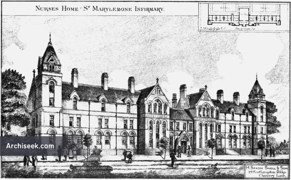
Opened by Princess Christian, daughter of Queen Victoria. Florence Nightingale established a Training School for Nurses at the Infirmary, one of the first in a poor law establishment. Perspective view with plan published in The Building News, March 5th 1885.
Map is being rolled out, not all buildings are mapped yet.